
LankaTrip Insights

30 min read

Pekoe Trail Stage 2 in 2026: Galaha to Loolkandura, the Birthplace of Ceylon Tea and the Landslide Section You Need to Know About

Stage 2 climbs 853 m from Galaha to the estate where James Taylor planted Sri Lanka's first tea in 1867. It is graded Difficult, it has been under amber status since January 2026 because of landslide damage in protected forest, and the trail organisation recommends against hiking it alone. None of that means you should skip it.

Back to blog
Pekoe Trail Stage 2 in 2026: Galaha to Loolkandura, the Birthplace of Ceylon Tea and the Landslide Section You Need to Know About

If you only walk one stage of the Pekoe Trail for what it means rather than how it looks, this is the one. Stage 2 ends at the Loolecondera Estate, where a young Scot named James Taylor planted nineteen acres of tea in 1867 and accidentally invented an industry that still defines this country's image abroad.

It is also the stage we cannot write about the way most travel articles are written, because the honest version requires leading with a safety advisory rather than a photograph.

Here is the situation as it stands. Stage 2 is open. It is not closed. But one section, between Delthota and the Hulan Ella Gala area, has been under what the trail organisation calls amber status since January 2026, following landslide damage on protected forest land. The organisation's own guidance is unusually direct: advanced hikers only, dry conditions only, groups of three or more, and it does not recommend solo hiking under any circumstances.

Most of the articles you will find about Stage 2 were written in 2023, 2024 or 2025 and describe a route that no longer reflects current conditions. That is not their fault; it is what happens when a landscape moves and a webpage does not. It is, however, a good reason to read something current before you set out.

What we want to be clear about is that this is not a reason to avoid Stage 2. The tea country between Galaha and Delthota is unaffected. The historic stretch into Loolkandura is unaffected. There is a recommended way to walk this stage right now that gives you the best of it while keeping you out of the flagged section, and we will explain exactly what it is.

This guide covers the current status in detail, the route as it actually walks, the history that makes it worth the climb, and the honest question of whether you personally should be on this trail at all.

Quick Summary

  • Stage 2 runs 14.7 km from Galaha Post Office to Loolkandura, climbing 853 m and descending 510 m to a maximum elevation of around 1,402 m
  • It is graded Difficult in both directions and is a significant step up from Stage 1
  • The section between Delthota and Hulan Ella Gala has been under amber status since January 2026 due to landslide damage on Forest Department land
  • The trail organisation recommends hiking the stage in reverse from Loolkandura, so you can turn back at the amber boundary
  • Groups of three or more are recommended, solo hiking is discouraged, and trail policy caps groups at 20
  • The stage reaches Loolecondera, the estate where James Taylor planted Sri Lanka's first commercial tea in 1867
  • An alternative route, Stage 2B, has been mapped and negotiated with landowners and is due for a beta release
  • A trail pass costs USD 10 per stage for foreign visitors, and Loolecondera Estate itself charges separately for entry

The Current Status: What Amber Actually Means

The Pekoe Trail Organisation uses a traffic-light status system for its stages, and Stage 2 has been amber since January 2026. The first thing to understand is that amber does not mean closed. It means proceed with caution and local knowledge.

The flagged section runs between Delthota and the Hulan Ella Gala area. It suffered severe landslides and remains the part of the stage under caution. The rest of Stage 2, including the tea country from Galaha through Delthota and the historic stretch into Loolkandura, is unaffected.

As of the most recent official update, conditions in the amber section are described as dry and overgrown. Dry means the ground is stable enough for an experienced hiker in current conditions. Overgrown means vegetation has reclaimed parts of the path since the last clearing, so expect narrow corridors of tall grass and stretches where the trail line is hard to see.

The official recommendation is to hike this section only during dry periods and to avoid it entirely on or after rainy days. The organisation's phrasing is worth quoting in spirit: wet ground on a landslide-prone slope is a different risk profile altogether.

There is a reason this has not simply been repaired. The Pekoe Trail Organisation does not own any of the land the trail crosses. It describes its role as steward and custodian of the trail experience, not landowner. The damaged section sits inside a protected area managed by the Department of Forest Conservation, so any restoration requires collaboration with the Department, the necessary approvals, and environmental safeguards before work can begin.

There is no fixed date for the amber status to be lifted. It depends on those approvals and on the scale of the restoration needed.

The stage pages also carry a separate, more recent precaution about slippery terrain and localised landslide risk following recent rainfall, advising caution and no solo hiking. That advisory is dated more recently than the amber update and applies alongside it.

None of this is us being alarmist on the trail's behalf. This is the managing organisation's own published position, and it is more candid than most tourism bodies would be. Take it seriously and check the live status yourself before you walk, because it will have moved on from the day this article was written.

Amber since January 2026, not closedFlagged section: Delthota to Hulan Ella GalaCurrently dry but overgrown with poor trail visibilityLand is managed by the Department of Forest ConservationNo fixed date for the status to be lifted

The Recommended Way to Walk Stage 2 Right Now

The trail organisation's own recommendation, and the one we would follow, is to hike this stage in reverse. Start at Loolkandura and walk back the way you came.

This sounds counterintuitive if you have just finished Stage 1 at Galaha and want to continue in sequence. Do it anyway, and here is why it works.

Walking in reverse from Loolkandura means you experience the tea country and forest sections around the Loolecondera Estate first, which is the most scenic and historically significant part of the whole stage. You then reach the amber boundary and decide, with the terrain in front of you rather than behind you, whether to continue toward Delthota or turn back.

You are never committed. A point-to-point walk in the forward direction commits you: once you are past Delthota heading uphill, turning back means losing the day. In reverse, turning around costs you the least valuable part of the route.

It also lets you skip the stretch between Galaha town and Delthota entirely if you want to. That section runs mostly through community areas and is, by the organisation's own assessment, the least essential part of the stage if your priority is the forest and highland scenery.

Practically, this means arranging transport to Loolkandura, walking out and back, and returning by the same vehicle. Loolkandura is reached by road from Kandy via Galaha Road through Hindagala, Mahakanda, Galaha and Deltota, then a further stretch on narrow winding roads inside the estate. A vehicle with decent ground clearance is advisable.

If you are set on the full point-to-point walk in the forward direction and you meet the advanced-hiker criteria, go in a dry spell, in a group, having checked the forecast for the Delthota area specifically rather than for Kandy, and having told your accommodation your route and expected return time.

Start at Loolkandura and walk in reverseYou keep the best scenery and stay uncommittedTurn back at the amber boundary if conditions look wrongSkipping Galaha to Delthota costs you littleCheck the Delthota forecast, not the Kandy one

Safety Requirements for This Stage

These are not our inventions. They come from the trail organisation's published guidance for the flagged section, and they are stricter than anything applied to Stage 1.

Hike in a group of three or more. This section is meaningfully safer with company, both for navigation on an overgrown path and for the obvious reason that unstable ground is a poor place to be alone with a turned ankle. Trail policy separately caps groups at 20 people.

Do not hike this solo. The organisation says it does not recommend solo hiking on this section under any circumstances. If you are travelling alone and determined to walk it, the recommendation is to bring a local community experience host with you, who knows the terrain and can give you real-time ground assessment as you walk.

Tell someone your plan. Your accommodation, your guide, or another contact should know your route, your start time and your expected return before you set out.

Check the forecast for the Delthota area specifically. General Kandy weather does not reflect conditions on this stretch. Check the night before and again on the morning of your hike.

Check the trail organisation's TrailWatch app before you leave. Conditions on this section change quickly with weather and TrailWatch is where updates land first.

Go in dry weather only, and turn back if rain starts or the ground begins to feel unstable underfoot. This is the single most important rule on the list.

Carry footwear with proper grip and be prepared for vegetation that reduces visibility of the path. Pack leech socks if there has been recent rain; this forest section is prime leech territory once conditions turn wet.

Save emergency numbers before you start rather than searching for them mid-hike, because mobile signal through the forest section is inconsistent. The nearest hospital is District Hospital Delthota and the nearest police station is Galaha Police Station; the Kandy Fire Brigade is also worth having saved.

And the honest catch-all: if any of this gives you pause, that is information rather than weakness. Walk the unaffected parts of Stage 2 and skip the flagged segment. You will still have seen the birthplace of Ceylon tea.

Groups of three or more; solo hiking not recommendedDry weather only, turn back if rain startsCheck the Delthota forecast and TrailWatchTell someone your route and expected returnSave emergency numbers before you lose signal

The Stage 2 Numbers

Stage 2 is 14.7 km long, with an elevation gain of 853 m and a loss of 510 m, reaching a maximum elevation of around 1,402 m. The official average duration is 5 hours. Region is Kandy, people interactions are rated High, and difficulty is Difficult in both forward and reverse directions.

Compare that with Stage 1's 13.01 km, 537 m of gain, and Easy grading, and you can see the jump. Stage 2 climbs over 300 m more in only 1.7 km of extra distance, and it does so in concentrated sections rather than gradually.

The five-hour official figure is a moving time for a fit hiker. Given that this stage involves sustained climbing, a market town worth stopping in, historically significant sites at the far end, and currently an overgrown section that will slow you down, we would plan on 6 to 8 hours of elapsed time for the full point-to-point walk.

The stage divides naturally into two halves that feel completely different. Galaha to Delthota is the shorter, gentler first part, mostly through estate roads and community areas with a lot of twists and turns near the town. Delthota to Loolkandura is the serious half: the climbing, the pine forest, the abandoned village, and the arrival into the high tea fields.

One thing the numbers do not capture is the character shift. The people-interaction rating of High applies mainly to the first half. The upper section feels far more remote than that rating suggests, which is part of its appeal and part of why the safety guidance is what it is.

For anyone doing the recommended reverse out-and-back from Loolkandura, your distance is entirely up to you. Reaching the amber boundary and returning gives you the historic estate, the high tea fields, the rock formations and the forest, at whatever total distance that works out to on the day.

14.7 km, 853 m gain, 510 m lossMaximum elevation around 1,402 mOfficial duration 5 hours; plan 6 to 8 elapsedGraded Difficult in both directionsTwo distinct halves either side of Delthota

James Taylor and the Birthplace of Ceylon Tea

The reason to endure the climb is at the far end, and it is one of the more genuinely significant historical sites in Sri Lanka that almost no tourist visits.

James Taylor arrived in Ceylon in 1852 as a teenager, contracted to work on a coffee plantation. Coffee was the colonial cash crop of the day and it was about to be destroyed by leaf rust disease, taking the island's economy with it.

In 1867 Taylor cleared nineteen acres at Loolecondera and planted tea. It worked. The industry that grew from that experiment reshaped the highlands, the economy and the demographics of central Sri Lanka, and the phrase Ceylon tea entered the global vocabulary because of what happened on this hillside.

Taylor made one decision that says something about him. Every other British planter named their estate after somewhere in Britain or someone they loved. Taylor kept the local name, Loolkandura, rendered in his own spelling as Loolecondera. He never returned to Scotland and died in Sri Lanka at 57.

What survives on the estate today includes Taylor's Seat, a rock seat with a wide view over the surrounding mountain ranges; the chimney of his log cabin, which is the only part of the structure still standing; his well; and the original tea patch, now known as No. 7 field. The Loolecondera Tea Factory still operates.

Walkers who have visited both consistently rate the view from Taylor's Seat above the far more famous Lipton's Seat near Haputale. From here you can see across the Victoria Reservoir toward Hunnasgiriya, the Knuckles Range and Thoppigala. It is not a small claim and we think it holds up.

Practical note: the estate is a working plantation and a visitor site in its own right, separate from the trail. It charges for entry and there is a vehicle parking fee. Published entry figures vary considerably between sources and we are not going to print a number we cannot verify, so budget for a modest charge and confirm on arrival. Opening hours are commonly given as 7:00 am to 5:00 pm daily.

The trail organisation's own guidance notes that hikers must follow landowner entry rules, and it names Loolecondera specifically among the places where that applies. Your trail pass is not an estate entry ticket.

Taylor planted Sri Lanka's first commercial tea here in 1867Taylor's Seat, his cabin chimney, his well, and No. 7 field surviveViews often rated above the more famous Lipton's SeatEstate charges separately for entry and parkingCommonly open 7:00 am to 5:00 pm daily

The Route in Detail, Galaha to Loolkandura

Described in the forward direction for clarity, though remember the current recommendation is to walk it in reverse.

The stage begins at Galaha Post Office with roughly a kilometre along the road toward Galaha General Hospital before leaving the main road for the Deltota Estate. The official guidance here is specific and worth remembering: locals may advise you to take the main road to Deltota or Loolecondera. Ignore that and keep left through the estate, which is far more scenic.

At around 1.3 km a signboard reading Welcome to the Deltota Estate marks a right turn. You pass a large school ground and some houses before the first steep section. Turn round as you climb; the view back over the Hanthana Estate and the surrounding mountains is one of the better rewards of the lower half.

At an intersection with a tea weighing station, take the path to the right. The trail here is wide and straightforward. As you approach the village it becomes more intricate and GPS becomes genuinely useful rather than optional.

At around 4.6 km there is an important left turn across a bridge. This is the point people most commonly get wrong. If you are unsure, ask; local residents reliably point walkers the right way here.

Deltota itself is a proper hill country town with a busy market and a striking green mosque. The market is worth the stop, both for fresh fruit and vegetables and because it is one of the few genuinely local moments on this part of the trail. Colourful murals around the area add to the character.

From Deltota, continue 50 m along the main Galaha road before turning steeply uphill to the left. The road becomes gravel and forks right. The next 2.5 km run through an old pine forest under tall trees. This section is prone to leeches and is worth preparing for rather than discovering.

At around 8.3 km the trail meets an old estate road zigzagging up the mountain. The views improve as you climb and the path stays wide and easy to follow. Near 9.3 km it levels out close to the summit, with a communications tower visible above and to the right. The terrain here can be slippery in wet weather.

At 9.7 km you pass an abandoned village and cross a small river. The path narrows for about 300 m, marked by concrete posts painted yellow and red. By 10.5 km it widens into a tea estate road leading into the upper divisions of Loolecondera.

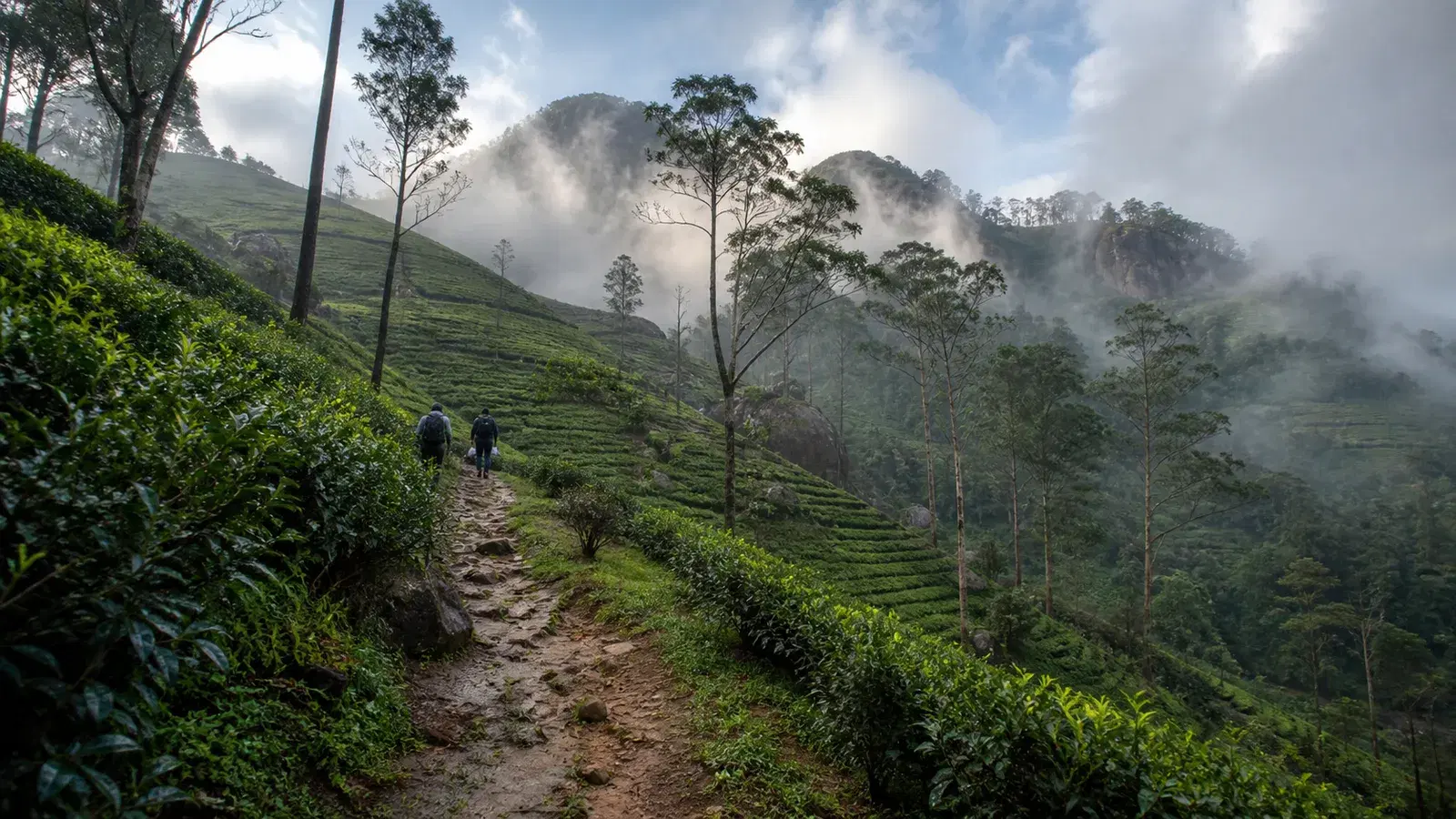
The highlight follows: a track on the right leads to James Taylor's original cottage. From there it is a gradual descent through tea bushes with massive rock formations and dense high-elevation rainforest around you.

The stage concludes at a bridge and a Hindu shrine. Just before that, an information centre with clean toilets sits on the right.

Keep left onto the Deltota Estate rather than the main roadImportant left turn over a bridge at around 4.6 kmDeltota market and its green mosque are worth a stop2.5 km of old pine forest, prime leech territoryAbandoned village and river crossing near 9.7 kmJames Taylor's cottage in the upper Loolecondera divisions

What Stage 2B Is, and Why It Matters

There is a plan to fix this, and it is not a repair. It is a reroute.

Stage 2B is a newly mapped alternative route that the trail organisation has developed and negotiated directly with the relevant landowners. Where the current amber section runs through protected forest with restricted access, Stage 2B is designed to pass through land where the organisation has direct agreement to operate.

This matters because it removes the dependency that has kept the amber status in place. The existing section cannot be repaired quickly, not through negligence but because Forest Department approvals and environmental safeguards take the time they take. Stage 2B sidesteps that entirely.

The plan announced was for a pre-launch beta, open to advanced hikers who want to be among the first to walk it. Beta access is self-guided, with hikers asked to feed ground data back through the TrailWatch app: trail condition, obstacles, wildlife sightings, anything that helps validate the route before it becomes permanent.

For most travellers this is background rather than actionable information. For a certain kind of hiker it is a genuinely appealing proposition: a chance to walk and help shape a new section of a national trail before it is finalised.

If that is you, watch the trail organisation's official channels for the release announcement rather than relying on secondhand reports. Timelines on projects like this move, and we would rather tell you where to look than print a date that ages badly.

The broader point for anyone planning a Pekoe Trail hike in 2026 or 2027: this is a living route managed by a small non-profit on land it does not own. Stages get flagged, rerouted and reopened. Check the official stage page and TrailWatch before every walk, not just this one.

A newly mapped and negotiated alternative to the amber sectionRuns through land with direct landowner agreementPre-launch beta for advanced hikersBeta hikers feed condition data back via TrailWatchWatch official channels rather than secondhand reports for dates

Leeches, Slippery Ground and Highland Hazards

The pine forest section between Deltota and the climb is explicitly flagged as leech-prone, and the amber section is described as prime leech territory once conditions turn wet. This is a stage where leech preparation is not optional in the wetter months.

Leech socks are the primary defence: long, tightly woven socks worn over your normal socks. They are inexpensive and widely available in Sri Lanka. Repellent products, including one sold through the trail organisation's own shop, work as a useful backup alongside socks rather than instead of them.

If a leech attaches, do not pull it off or burn it. Ease it off sideways at the mouth end or let it finish, then clean and cover the bite. It will bleed longer than you expect because of the anticoagulant. This is normal and not dangerous.

Slippery ground is the more serious hazard here. The section near the summit around 9.3 km is specifically noted as slippery in rain, and the amber section sits on a landslide-prone slope where wet ground changes the risk profile entirely.

Overgrown vegetation reduces visibility of the trail line in the flagged section. This creates two problems: navigation, and not being able to see what your foot is about to land on. Both are worse when you are tired and moving fast at the end of a long day, which is an argument for starting early.

Mobile signal through the forest is inconsistent. Do not plan on being able to call for help, look up directions or check the weather mid-route. Download everything you need and save numbers offline.

Highland thunderstorms build in the afternoon and you do not want to be on the exposed upper sections when one arrives. Early starts solve most of the weather problems on this stage.

Finally: this is high-elevation rainforest and estate country with genuine wildlife. Encounters are unlikely on a busy trail day but this is not a managed park with fences. Make normal noise, do not approach animals, and keep food packed away.

Pine forest section is explicitly leech-proneLeech socks first, repellent as backupSlippery ground near the summit in rainOvergrown vegetation hides both the path and the footingAfternoon thunderstorms; start early

Getting to Galaha and Loolkandura

Galaha Post Office, the forward starting point, is the same location where Stage 1 finishes, which makes the two stages naturally sequential if you are walking both.

Galaha is reached by road from Kandy along Galaha Road, passing through Hindagala and Mahakanda. It is a modest hill town with local bus connections back toward Kandy, though schedules are informal and the last useful service is earlier than most tourists assume.

Loolkandura, at the far end, requires more effort. From Kandy the drive runs roughly 34 km along Galaha Road via Hindagala, Mahakanda, Galaha and Deltota to the estate entrance. From there it is a further four kilometres on narrow winding roads inside the estate to reach the main landmarks.

That final estate stretch is rough. A vehicle with high ground clearance is strongly advisable and a four-wheel drive is the safer choice, particularly in wet conditions. Standard saloon cars do make it, but drivers who know the road will tell you it is not comfortable.

For the recommended reverse walk, this means arranging a driver who is willing to take the estate road, wait, and take you back. Discuss this explicitly when booking rather than assuming, because some drivers will decline once they see the surface.

There is a parking fee at the estate for vehicles, separate from the entry charge.

As with the whole hill country in 2026, remember that Kandy itself is currently reached by road rather than rail while the Rambukkana to Nanu Oya section of the Main Line remains closed for repairs after Cyclone Ditwah. Reopening is expected around January 2027. Build longer transfer times into your planning than the guidebooks suggest.

Whichever end you start from, agree your pickup point and approximate time before you set off. Signal along the route is unreliable and renegotiating mid-hike is not a plan.

Galaha is reached by road from Kandy via Galaha RoadLoolkandura is roughly 34 km from Kandy plus 4 km of estate roadHigh clearance or 4x4 strongly advisable for the estate roadParking fee at the estate, separate from entryKandy is road-access only in 2026 due to the rail closure

When to Walk Stage 2

The general Pekoe Trail advice of December to March holds for this stage, and here it carries more weight than usual because the flagged section is explicitly conditions-dependent.

January to April is our recommendation. Firmer ground, lower leech pressure, better visibility of the trail line before vegetation growth accelerates, and a much better chance of the Loolecondera views actually appearing.

The southwest monsoon, roughly May to September, brings the wetter weather to this side of the highlands. That is precisely the period when the official guidance says to avoid the amber section entirely, and when the pine forest becomes serious leech country.

But annual seasons are the wrong resolution for this particular stage. What matters more is the last few days. A dry January week after unusual rain is worse than a dry September week after a settled spell. Check recent conditions, not just the month.

Time of day matters too. Start early. Mist builds through the afternoon in the highlands, thunderstorms follow, and the sections where footing matters most are the ones you want to cross while you are fresh and the light is good.

Realistically, for the full point-to-point walk you want to be moving by 7:00 am. For the reverse out-and-back from Loolkandura you have more flexibility, but the estate opens at 7:00 am and starting near then gives you the whole day.

There is no reliable way to predict from abroad what conditions will be on your specific date. What you can do is build flexibility into your itinerary so that if the forecast turns, you can move this hike to another day rather than walking it in the wrong weather because it was the only slot you had.

January to April is the strongest windowRecent conditions matter more than the calendar monthSouthwest monsoon months are when the advisory bites hardestBe moving by 7:00 am for the full stageBuild itinerary flexibility so you can move the hike

Why a Guide Matters More on This Stage

On Stage 1 we told you a guide was a nice-to-have. On Stage 2, our position changes, and the trail organisation's own guidance supports that shift.

The organisation explicitly encourages solo hikers to bring a local community experience host along on the flagged section, and gives a specific reason: they know the terrain, they can flag changes since your last TrailWatch check, and they give you real-time ground status as you walk.

That last point is the one that matters. Published conditions describe the state of the trail when someone last assessed it. A local walking beside you describes the state of the trail under your feet right now. On a landslide-affected slope with overgrown vegetation, that difference is not academic.

There is a navigation argument too. The intricate section near the village before Deltota and the important bridge turn at 4.6 km both catch people out, and the amber section's overgrowth reduces trail visibility further.

And there is the interpretation argument, which on this stage is unusually strong. Walking past Taylor's cottage without understanding what happened there is a waste of a significant place. Someone who can explain the coffee blight, the transition to tea, the labour history of the plantation system and what the estate divisions mean turns a hard hike into something you will remember properly.

When choosing, ask specifically whether they have walked Stage 2 recently and what they know about current conditions in the flagged section. A guide who has not been up there in months is offering you their reputation rather than their knowledge. Ask what their turn-back criteria are. A good one will have an answer.

We do not name individual guides, companies or hotels on this site as a matter of policy. What we can do is help you find someone vetted through our own platform, and give you the questions to ask whoever you end up walking with.

The trail organisation encourages solo hikers to bring a local hostReal-time ground assessment beats published conditionsTwo navigation pinch points before DeltotaThe history here needs interpretation to landAsk about recent experience and turn-back criteria

Hiking Stage 2 Responsibly

This stage passes through a working plantation, a protected forest, a busy hill town and an active historic site. Each of those asks something slightly different of you.

In the estates, stay on the marked path. Do not cut between tea rows. Do not pick leaves. The bushes are somebody's income and the plucking cycle is a managed process, not scenery.

At Deltota, remember you are walking through a town where people are shopping and working. The market is welcoming and photogenic, and it is also not a set. Ask before photographing stallholders and buy something if you have spent time there.

The green mosque, the kovils along the route and the Suduwella Temple are places of worship. Cover shoulders and knees, remove shoes where indicated, and do not photograph during observances.

In the protected forest section, the environmental case is direct: the land is managed by the Department of Forest Conservation and the trail's access there is conditional. Stay on the line of the path even where vegetation makes it tempting to find your own way, carry out everything you brought in, and do not cut vegetation.

At Loolecondera, pay the entry charge and respect the estate's rules. It is a working factory and plantation with a visitor operation attached, not a museum with a plantation attached.

Buy locally. The Deltota market, village shops, a guide's day rate, a meal at a guesthouse along the route. The trail was funded and built to bring economic opportunity to rural communities and that only works if hikers spend money.

Group size is capped at 20 people under trail policy. That interacts with the recommendation to hike in groups of three or more: the target zone is a small group, not an organised expedition.

And if you take one thing from this section: your trail pass is permission to walk, not permission to do whatever you like on other people's land. Landowner access is the entire foundation of the route and it is renewed by behaviour, not by payment.

Stay on the path; do not cut between tea rowsDeltota market is a town, not a photo setCover up at the mosque, kovils and templesPay the Loolecondera entry charge and follow estate rulesGroups of 3 to 20 under trail policy

Should You Walk Stage 2? An Honest Verdict

We would rather lose the pageview than have someone walk into a flagged section they were not ready for, so this is the direct assessment.

Walk Stage 2 if you are an experienced hiker, comfortable on unclear and uneven ground, travelling with at least two others or a local host, and able to move your hiking day if the weather turns. For that person, this is one of the best stages on the entire trail and the history at the far end is genuinely worth the climb.

Walk the unaffected portions if you are a reasonably fit hiker who wants the Loolecondera experience without the flagged section. The reverse out-and-back from Loolkandura gives you the estate, the high tea fields, the rock formations and the forest, and you turn back before the amber boundary. This is the option we would recommend to the majority of readers.

Do not walk the flagged section if you are alone, if it has rained in the last few days, if you are not confident with route-finding on an overgrown path, or if any part of the safety guidance made you hesitate. The organisation's own advice is advanced hikers only and it is not being precious about it.

Do not bring young children on this stage. It is graded Difficult, it climbs 853 m, and part of it is currently flagged. Stage 1 exists and is a much better family option.

Do not treat this as your warm-up hike. If you have not walked Stage 1 or something comparable, start there and come back to this one.

And do not skip Loolecondera entirely just because the trail between it and Delthota is flagged. You can drive to the estate, visit Taylor's Seat, the cabin chimney, the well and No. 7 field, and walk the upper estate sections without touching the amber zone at all. The history does not require the hard section.

The Pekoe Trail is a young project run by a small organisation across land it does not own, in a country where the highlands genuinely move after heavy rain. That it publishes candid amber advisories rather than quietly hoping for the best is a point in its favour. Read the live status, take it at face value, and plan around it rather than through it.

Best for experienced hikers in a group, in dry conditionsReverse out-and-back suits most readersNot a family stage and not a warm-up hikeLoolecondera is reachable by road without the flagged sectionCheck the live status; it will have changed since publication

Travel Tips

  • Check the official Stage 2 page and the TrailWatch app the night before you walk; the advisory changes with conditions
  • Hike in a group of three or more and do not attempt the flagged section alone
  • Check the forecast for the Delthota area specifically, not for Kandy
  • Walk the stage in reverse from Loolkandura so you can turn back at the amber boundary
  • Go only in dry conditions and turn back if rain starts or the ground feels unstable
  • Pack leech socks; the pine forest section is explicitly leech-prone after rain
  • Save District Hospital Delthota, Galaha Police Station and the Kandy Fire Brigade numbers before you lose signal
  • Tell your accommodation your route, start time and expected return
  • Budget separately for Loolecondera Estate entry and vehicle parking on top of your USD 10 trail pass
  • Use a high-clearance vehicle for the four kilometres of estate road to Loolkandura
  • Carry at least two litres of water and drink around half a litre per hour
  • Start by 7:00 am for the full stage to stay ahead of afternoon mist and storms
  • Keep your itinerary flexible so you can move this hike if the weather turns
  • Remember your trail pass is not an estate entry ticket

Frequently Asked Questions

Is Pekoe Trail Stage 2 closed?

No. Stage 2 is open. One section between Delthota and the Hulan Ella Gala area is under amber status following landslide damage and is recommended for advanced hikers only, in dry conditions. The rest of the stage, including the tea country from Galaha through Delthota and the historic stretch into Loolkandura, is unaffected.

What does amber status mean on the Pekoe Trail?

Amber means proceed with caution and local knowledge. It is not a closure. For Stage 2 it currently signals landslide damage on protected forest land, an overgrown path, and a recommendation to hike only in dry conditions, in groups, with advanced hiking experience.

Can I hike Stage 2 alone?

The trail organisation does not recommend solo hiking on the flagged section under any circumstances. It recommends groups of three or more, and suggests solo travellers who are determined to walk it bring a local community experience host along.

Why has the landslide damage not been repaired?

The affected land sits inside a protected area managed by the Department of Forest Conservation, and the trail organisation does not own any of the land the route crosses. Restoration requires collaboration with the Department, the necessary approvals and environmental safeguards before work can begin. There is no fixed date for the amber status to be lifted.

What is the safest way to experience Stage 2 right now?

Start at Loolkandura and hike in reverse. You can turn back at the Delthota boundary and will still have covered the most scenic and historically significant part of the stage, without committing to a point-to-point route.

How long and how hard is Stage 2?

It is 14.7 km with 853 m of elevation gain and 510 m of loss, reaching a maximum of around 1,402 m. The official average duration is 5 hours; we suggest planning 6 to 8 hours elapsed. It is graded Difficult in both forward and reverse directions.

What is Stage 2B?

Stage 2B is a newly mapped alternative route that the trail organisation has developed and negotiated directly with landowners, designed to bypass the flagged protected-forest section. A pre-launch beta for advanced hikers has been announced, with beta hikers asked to report conditions back through the TrailWatch app. Watch the organisation's official channels for the release.

Why is Loolecondera Estate significant?

It is where James Taylor planted Sri Lanka's first commercial tea in 1867, after coffee leaf rust destroyed the island's previous cash crop. Taylor's Seat, the chimney of his log cabin, his well, and the original tea patch known as No. 7 field all survive there, and the Loolecondera Tea Factory still operates.

Do I need to pay to enter Loolecondera Estate?

Yes. The estate charges for entry and there is a separate vehicle parking fee, both independent of your Pekoe Trail pass. Published entry figures vary between sources, so budget for a modest charge and confirm on arrival. Opening hours are commonly given as 7:00 am to 5:00 pm daily.

Are there leeches on Stage 2?

Yes. The 2.5 km pine forest section after Deltota is explicitly noted as prone to leeches, and the flagged forest section becomes prime leech territory once conditions turn wet. Leech socks are the effective defence, with repellent as a backup.

How do I get to Loolkandura?

By road from Kandy, roughly 34 km along Galaha Road through Hindagala, Mahakanda, Galaha and Deltota to the estate entrance, then a further four kilometres on narrow winding roads inside the estate. A vehicle with high ground clearance is strongly advisable.

Is Stage 2 suitable for families or beginners?

No. It is graded Difficult, climbs 853 m, and part of it is currently flagged for advanced hikers only. Stage 1 from Hanthana to Galaha is the appropriate family and beginner option in this area.

Can I see James Taylor's Seat without hiking?

Yes. Loolecondera Estate is reachable by road and operates as a visitor site in its own right. You can drive in, pay the entry charge, and see Taylor's Seat, the cabin chimney, the well and No. 7 field without walking the flagged trail section at all.

Is mobile signal available on Stage 2?

Signal is rated poor along the route and is specifically described as inconsistent through the forest section. Save emergency numbers and download offline maps before you start rather than relying on searching mid-hike.

Reader notes

Join the conversation

Share your question, tip, or travel experience for this guide.

Comments

0 comments

Loading...

Ready to turn inspiration into a Sri Lanka trip?

Use LankaTrip to plan your journey, connect with local guides, and make this itinerary a reality.

Need help planning?

Plan your Sri Lanka adventure

Plan my trip